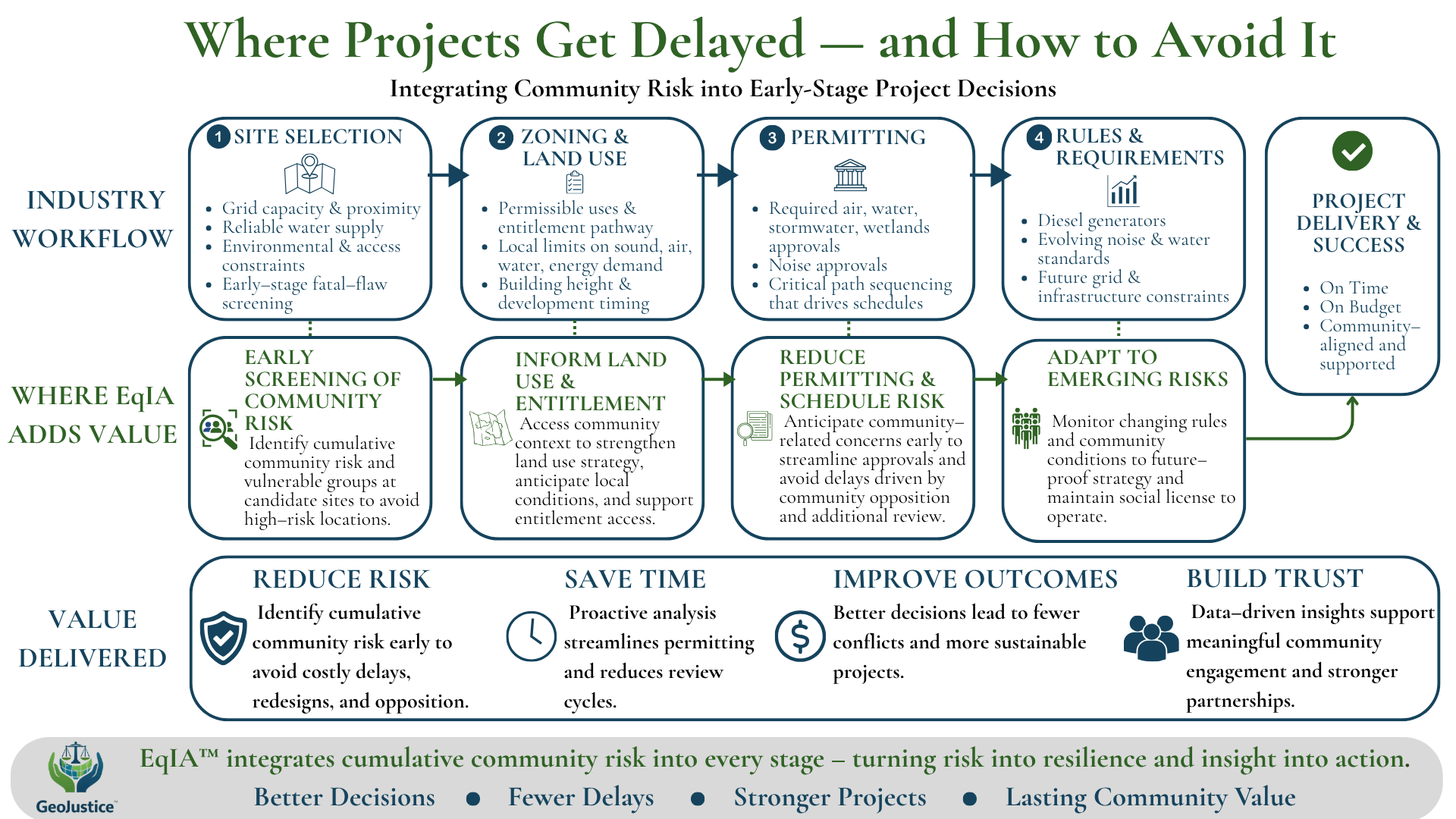
Integrating community risk into early-stage infrastructure decisions.

GeoJustice™ helps developers, governments, and institutions identify cumulative community risk early — reducing delays, strengthening approvals, and improving project outcomes.

Truth Brokers Through Data™

What GeoJustice™ Does

GeoJustice™ helps organizations identify and manage community-related project risk — before it delays permitting, increases costs, or triggers opposition.

We translate complex environmental, health, and infrastructure data into decision-ready insight that supports faster approvals, stronger projects, and more defensible outcomes.

Core Services:

Community Risk Screening (EqIA™)

  • Identify cumulative community risk and vulnerable populations early to inform site selection and avoid high-risk locations.

Land Use & Permitting Strategy

  • Strengthen zoning, entitlement pathways, and approval conditions using place-based community insights.

Risk Reduction & Project Support

  • Anticipate and address community concerns early to reduce delays, redesigns, and opposition.

GeoJustice™ also supports the development of data-driven, defensible community benefit strategies aligned with local conditions and cumulative risk.

What Makes GeoJustice™ Different

GeoJustice™ integrates community risk into the same decisions that determine project success — site selection, land use, permitting, and infrastructure strategy.

Most projects address community impacts too late.

GeoJustice™ brings that analysis upstream — where it reduces risk, avoids delays, and improves outcomes

Featured Work

Example application:

Urban Data Centers & Fence-line Forests™(←Click Here)

An applied Equity Impact Assessment (EqIA™) examining how large-scale data infrastructure intersects with environmental and community burdens.

This analysis explores how siting decisions—often driven by land availability and infrastructure access—can reinforce or shift existing patterns of environmental and social vulnerability.

Approach

GeoJustice™ follows a simple, grounded framework:

Reveal

  • Identify community risk

Translate

  • Turn data into decision-ready insight

Inform Action

  • Reduce risk and improve outcomes

About GeoJustice™

GeoJustice™ was founded to bridge the gap between community impact and infrastructure decision-making.

GeoJustice™ was founded by Matthew T. Lee, an environmental justice and geospatial policy professional with nearly two decades of experience in federal environmental policy and applied mapping.

Matthew spent over 17 years at the U.S. Environmental Protection Agency, where he helped lead the development and application of environmental justice screening and mapping tools and trained more than 10,000 stakeholders.

He currently serves as a Lecturer at the University of Pennsylvania and as Compliance Officer for a $50+ million EPA-funded grant portfolio supporting more than 200 community-driven projects.

His work is grounded in the belief that data can serve as a tool for equity—when it is made accessible, transparent, and actionable.

Let’s Connect

If you’re planning or evaluating a project where community risk could impact approvals, timelines, or outcomes — let’s connect.

Initial engagements and pilot projects now forming.